 |
Lajitas
is a small community located near Big Bend National Park in Brewster County, Texas. Big Bend National Park is one of the largest national parks in the U.S., but one of the least visited. Its' remote location in the Chihuahuan Desert is the reason for that, but even so, about 300,000 to 350,000 people visit each year. The park covers 801,163 acres and includes more than 1,200 species of plants, more than 450 species of birds, 56 species of reptiles, and 75 species of mammals. Archaeologists have discovered artifacts estimated to be 9,000 years old in Big Bend Park. For more than 1,000 miles, the Rio Grande/Río Bravo River forms the international boundary between Mexico and the United States, and Big Bend National Park administers approximately 244 miles along that boundary. Most of the animals in Big Bend Park are not visible in the day, particularly in the desert. However, the park comes alive at night, with many of the animals foraging for food. Animals that live in Big Bend National Park include cougar, black-tailed jackrabbit, kangaroo rat, greater roadrunner, coyote, Mexican black bears and golden eagles. Activities in Big Bend, near Lajitas, include hiking and backpacking along 245 miles of the Rio Grande. There are also professional river outfitters that provide tours of the river, and birdwatching is also popular. As of 2009, the Department of Homeland Security began treating all float trips as trips that had left and re-entered the country, and required participants to have an acceptable form of identification, such as a passport.

|
Lajitas Vacation Rentals
|

|
|
|
|
|
Lajitas Hotels and Resorts
|
|
|
| | | Hotels & Motels |
| Big Bend Motor Inn | Intersection SH 118 & 170 | Terlingua, TX | 10.6 mi. | (432) 371-2218 |

|
Lajitas Weather & Climate
|

|
|
|
The Western Big Bend Region of Texas has an arid, desert climate with very hot summers and mild winters. There is usually little to no humidity in summer. Also called the Trans-Pecos Region, it's the region farthest west in the state and consists of both desert and mountains. It's the driest area of the state, and receives the most sunshine statewide - the sun shines 302 days per year. The average annual rainfall is only 9 to 16 inches. Most rainfall is received in the summertime, and thunderstorms are possible. Temperatures in the higher mountain areas are slightly cooler than below. Occasional, brief periods of cloudy weather may occur during the winter months. Snow is rare, but occasional cold fronts can bring temperatures well below freezing. Due to the dry climate, the area often has wind and dust storms, especially from March to early May.
|
| Month |
High Temp |
Low Temp |
Rainfall |
Ocean Temp |
| January |
69°F |
34°F |
0.30 in. |
- |
| February |
76°F |
39°F |
0.28 in. |
- |
| March |
83°F |
46°F |
0.13 in. |
- |
| April |
91°F |
54°F |
0.29 in. |
- |
| May |
97°F |
63°F |
0.95 in. |
- |
| June |
101°F |
72°F |
1.44 in. |
- |
| July |
100°F |
73°F |
2.15 in. |
- |
| August |
98°F |
72°F |
1.28 in. |
- |
| September |
94°F |
67°F |
1.53 in. |
- |
| October |
87°F |
56°F |
1.32 in. |
- |
| November |
76°F |
42°F |
0.29 in. |
- |
| December |
69°F |
35°F |
0.23 in. |
- |

|
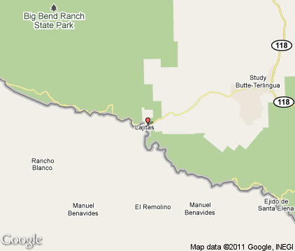
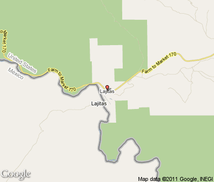
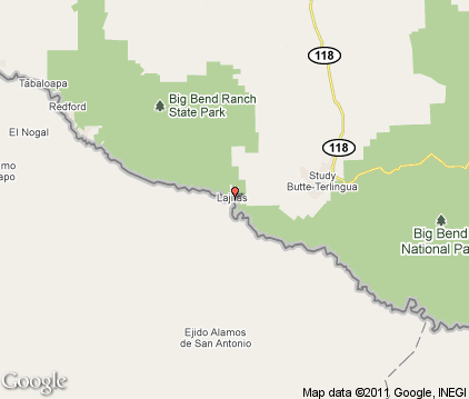
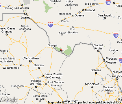
Lajitas Map & Transportation
|

|
|
 |
|
|
| Click each thumbnail image to enlarge. |
 |
|
 |
 |
The closest airports in the area are the Presidio Lely International airport (T77) located about 43 miles northwest of Lajitas in Presidio, Texas.
|

|
Lajitas Attractions
|

|
|
Notice a problem with the information on this page? Please notify us.
|
Disclaimer: We recommend you conduct your own research regarding all accomodations and attractions found on this website. The distances shown on this website are straight-line distances as the crow flies. The road distance may be considerably longer. You assume all liability for use of any information found on this website. No information is confirmed or warranted in any way. By using our services you agree to the terms and conditions of this disclaimer.
|
| We are the #1 site for your Texas Vacations presenting Texas vacation rentals, hotels, weather and map for each city. |
Texas Vacations .com
©1997-2025 All Rights Reserved.
|
|